Commack-raised entertainer brings deeply personal solo performance exploring loss, motherhood, reinvention and starting over after… Read More →

Commack-raised entertainer brings deeply personal solo performance exploring loss, motherhood, reinvention and starting over after… Read More →

National Weather Service warns swimmers across Long Island’s south shore, including East End beaches, of… Read More →

Evelyn Alexander Wildlife Rescue Center brings rehabilitated raptors to Landcraft Garden Foundation for a family-friendly… Read More →

Three-day event July 28-30 features professional beach volleyball, youth clinics, wellness experiences and community fundraising… Read More →

Nearly 240 guests attended the annual event supporting French Heritage Society’s preservation and educational programs.… Read More →

Women’s health advocates joined supporters at Maidstone Club as the annual East Hampton fundraiser surpassed… Read More →

Award-winning actress brings Tony-nominated solo play to the Hamptons for one-night-only reading presented by The… Read More →

Police say a 63-year-old Bronx man drove through the gated entrance of the couple’s Georgica… Read More →

Designers, collectors and history enthusiasts gathered in East Hampton to support the Historic House Trust… Read More →

Stefan Soloviev has amassed one of the largest private land holdings in America. Now, his… Read More →

A powerful winter storm is poised to slam the Tri-State area from Sunday afternoon through Monday morning — with Long Island, especially Suffolk County, in the bull’s-eye for the highest snowfall totals.
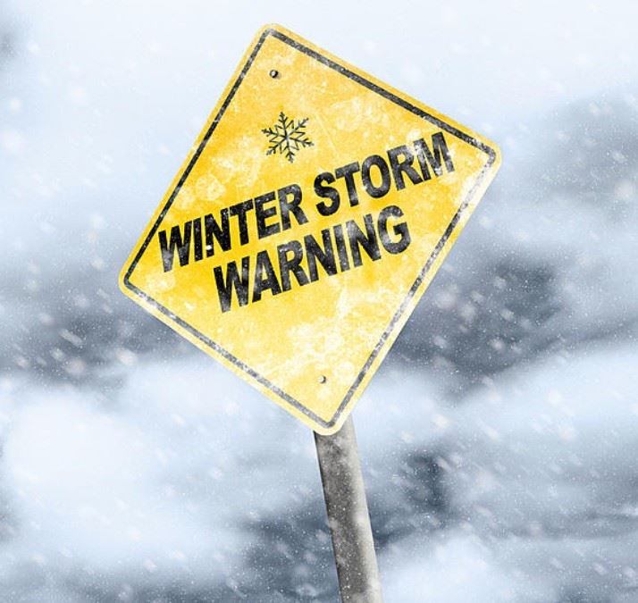
The National Weather Service has issued a blizzard warning for New York City and Long Island from 6 a.m. Sunday through 6 p.m. Monday — the first blizzard warning for the area in years. Winter storm warnings extend north and west into the Lower Hudson Valley and interior Connecticut.
Forecasters say this could be the region’s biggest snowmaker since the historic January 2016 storm and the first true blizzard conditions here since 2017.
Just as students return to classrooms following February break and travelers head back to New York from warm-weather escapes, the region is bracing for what could be one of its most disruptive winter storms in nearly a decade.
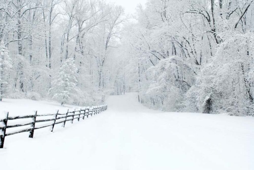
Heavy, wet snow is expected to overspread the region Sunday, with totals climbing quickly as temperatures drop and winds intensify.
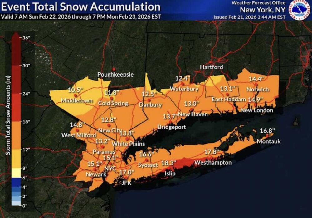
Projected snowfall totals:
• Suffolk County: 18 to 22 inches possible
• Nassau County: 16 to 24 inches possible
• New York City: 13 to 18 inches likely, with isolated higher totals
• Brooklyn and Queens: 16 to 17 inches, with potential for locally higher banding
Eastern Long Island remains particularly vulnerable to heavier coastal snow bands, which could significantly boost accumulations in parts of Suffolk County.
The most intense part of the storm is expected late Sunday afternoon through sunrise Monday.
Snowfall rates could reach 2 to 3 inches per hour, especially across Long Island and coastal New York City. Wind gusts up to 55 mph may create near-zero visibility and whiteout conditions, making travel extremely dangerous — if not impossible — Sunday night into early Monday.
Heavy, wet snow combined with strong winds raises the risk of downed trees and power lines, widespread power outages, and significant disruptions across road, rail and air travel.

Minor to moderate coastal flooding is possible during high tides, particularly along the South Shore of Long Island, Jamaica Bay, Staten Island, the Battery, and portions of Queens and the Bronx.
Water levels could rise 2.5 to 3 feet above normal high tide, prompting a Coastal Flood Warning.
Saturday remains the calm before the storm, with increasing clouds and highs in the mid-to-upper 40s.
Light snow begins around sunrise Sunday. Early temperatures just above freezing may limit initial accumulation, with perhaps a slushy inch by early afternoon. As colder air wraps into the strengthening coastal system, snowfall becomes steadier and heavier through the afternoon and evening.
By Sunday night, the storm rapidly intensifies offshore, locking in colder air and transitioning all precipitation to heavy snow.

For residents in New York City and across Long Island — especially in Suffolk County — this is shaping up to be a significant, high-impact winter event. Travel plans Sunday into Monday should be reconsidered, and preparations for potential power outages are strongly advised.
*In response to severe weather conditions, The Town of East Hamptons and the Town of Southampton issued the following statements:
East Hampton Town has declared a State of Emergency effective 6:00 AM Sunday, February 22 in response to a severe winter storm.
In addition, all East Hampton Town Offices and Facilities will be closed on Monday, February 23, 2026.

A significant snow event is expected. A Blizzard Warning has been issued by the National Weather Service for our area. The forecast now indicates that we may receive 13-18″ of snow between Sunday & Monday. Coastal flooding and gusty winds as well.
– Residents are urged to avoid travel during the storm.
– Be mindful of ponding and pooling of water on roadways and avoid driving into flooded roadways. Flooding in coastal areas may also be covered by snow and may be more dangerous than it appears. Use extreme caution.
– Move cars off the roads before and during snowfall to allow plows to navigate roadways more easily and successfully without obstructions.
– Do Not push snow from properties into roadways.
– Use caution on any untreated surfaces during the storm as they may be slippery.
– Expect possible delays or prolonged travel times on Monday due to any potential storm impacts.